TEAM MEMBERS

Lesly Tineo


Sheily Sapeg
Angel Dudiel

Lisandro Martini

Karen del Jesus

Mayra Hernandez
CHALLENGE:
MEASURING THE VALUE OF EARTH OBSERVATIONS
Information from Earth-observing satellites is used to make decisions that benefit society and the environment, but it can be challenging to document how this information leads to improved outcomes and to measure these improvements. Your challenge is to describe how Earth observations inform a specific decision that improves outcomes for society and propose a strategy for measuring these benefits.
The value of Earth observation through the voyage42 algorithm
"If the information is not of value to the society in which one lives, it simply ceases to be important and therefore useful."
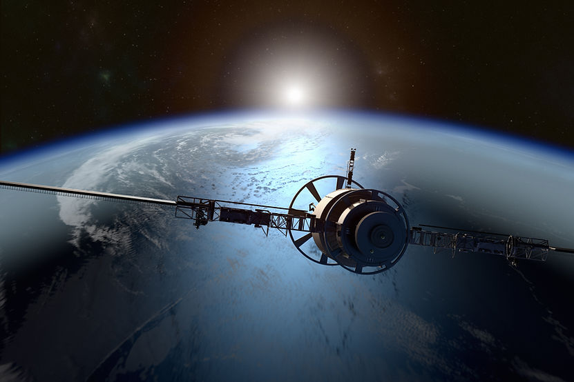
On April 1, 1960, NASA launched the first meteorological satellite, starting what we could call a new era, this same satellite detected days later by means of an image of a typhoon approximately a thousand kilometers from Australia. “In the time before the images, the weather caused many deaths because we did not have the ability to predict the severity of storms. With images we can predict, evaluate and provide information to make decisions in many situations "
Because of the above as a team, we believe that by measuring the contribution of satellite information on the economy, the quality of human life and the environment, we can, in this way, find what value it has and this is the approach that we want to take to solve this challenge.

To express the value of earth observation we must take into account the benefits to society, the economy and the environment.
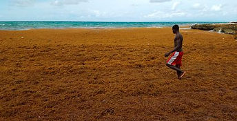
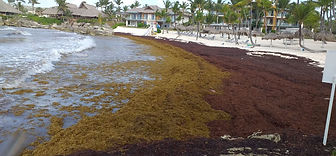
Sargassum is a type of seaweed of the species Sargassum Natans and Sargassum Fluitans. This seaweed has been present in tropical areas for a long time, but due to climate change, Sahara dust and the large amount of organic waste it has reproduced more frequently. The sargassum contains structures called aerocytes, these are formed by gases that make the sargassum able to float.
The sargassum is a harmful entity that is causing mortality in the flora and fauna where it lives, there is a loss of water quality and when the sargassum begins to decompose it gives off a putrid odor and the particles are released into the open air, which ends up affecting people near these locations where the sargassum is creating respiratory problems for children, adolescents and adults due to exposure to harmful metals such as mercury, zinc and lead.
In addition, these algae present a great threat to countries such as the Dominican Republic and Mexico, countries that depend on tourism for a large part of their economies, but because of sargassum, many tourists stop visiting these countries during certain seasons, which generates economic problems for them.
Thanks to satellite information it is possible to observe the places where these algae are found and to calculate the arrival of this algae to the coasts of Caribbean, North American and Central American countries through the thermohaline currents of the oceans.


Companies such as AlgeaNova have set out to find a solution to the problem that sargassum represents for tourism and people's quality of life. This group has invested more than 1 million euros in sargassum research. Thanks to the data collected in this research, the company came up with a solution, began to implement barriers in different strategic points of the Dominican Republic, and installed the first multipurpose plant for the transformation, use, and valorization of sargassum in the country.
This is an example of how Earth observation can benefit society, since part of the data used in this research comes from satellites and scientific research, thus improving the quality of life of the inhabitants of the eastern coasts of the Dominican Republic and the economy of the country, considering that 15% of the Dominican GDP belongs to tourism.
Earth observation can be used not only for sargassum research but also for agriculture, forestry, resilience to natural disasters, urban development, climate resilience, among others...
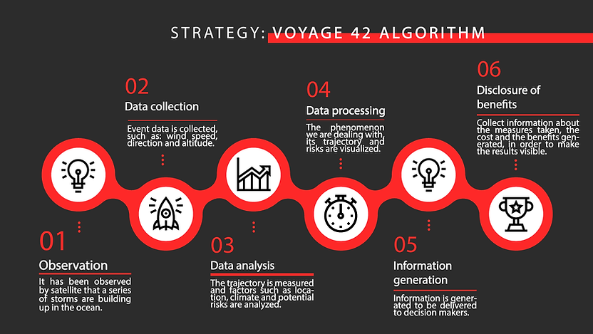
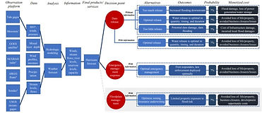
In the case of hurricanes, the process of moving from simple observation or data to a quantifiable benefit for society, I believe that this can be achieved through value chains. A value chain is shown in figure 1.
This value chain expresses how from the observation we get to collect data and analyze them to obtain information that translates into a natural phenomenon such as hurricanes and how from having the information we get to decision making, thanks to satellite information we can make an informed decision in which we can take measures in an optical way which generates less human, economic and environmental losses.
If we do not have this information, we will depend on luck, wasting resources and sending false alerts, which ends up causing more damage to society.
Pearlman, F., Lawrence, C.B., Pindilli, E.J., Geppi, D., Shapiro, C.D., Grasso, M., Pearlman, J., Adkins, J., Sawyer, G., and Tassa, A., 2019, Demonstrating the value of Earth observations—Methods, practical applications, and solutions—Group on Earth Observations side event proceedings: U.S. Geological Survey Open-File Report 2019–1033, 33 p., https://doi.org/10.3133/ofr20191033.
ISSN: 2331-1258 (online)

Our Strategy